
Together, designers and locals figured out what the the long green axis should look like. It runs along the Southern Round Railway from Budaörsi street to the Danube, was developed by the designers, said Dávid Vitézy, director of the Budapest Development Center (BFK), on his Facebook page.
As reminded, the expansion of the capacity of the railway section from Kelenföld to Ferencváros, which also crosses the Danube, and the implementation of the Southern Round Railway, is essential in order for the suburban trains currently running every half hour to run every ten minutes or more. In addition to the existing tracks, new ones will be built, as well as three completely new railway stations, including one in Buda, at the Kopaszi Dam, called Nádorkert.
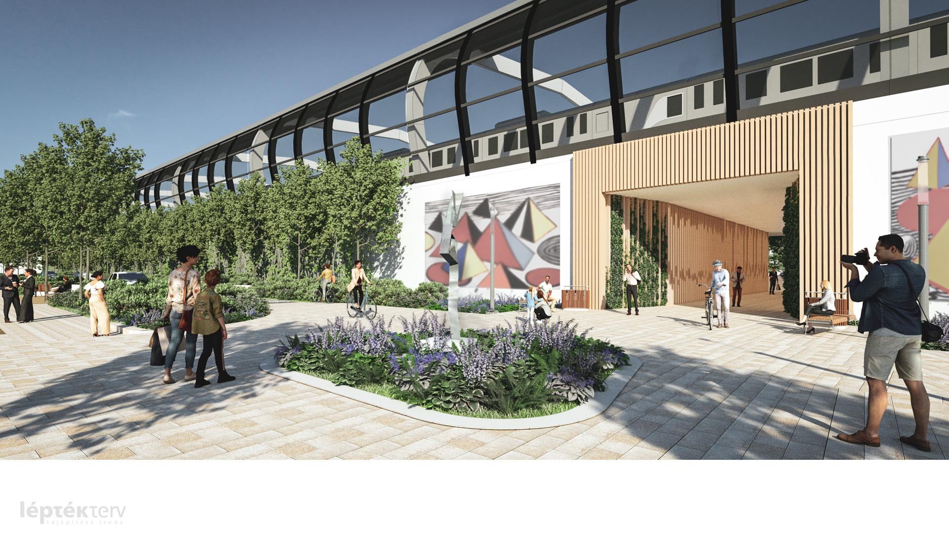
Several crossings open under the railway (Source: Dávid Vitézy / Facebook)
Urban areas are arranged in the areas along the railway, furnished according to the needs of pedestrians, cyclists, walkers and resters. This also affects many areas of the railway that are now neglected, he said.
He also stressed that the landscaping is expected to be largely only after the railway development. According to the contract of construction, the development of the Southern Round Railway will last until the end of 2027, so the parks shown in the plans will be built after that.
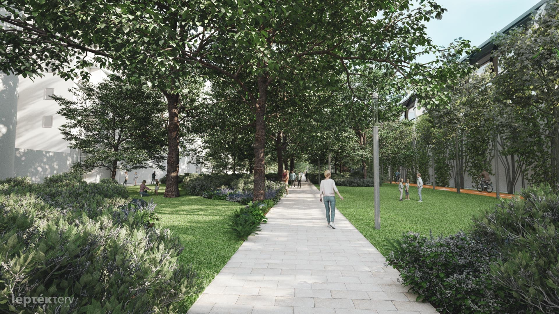
The park along Hamzsabég road (Source: Dávid Vitézy / Facebook)
Dávid Vitézy emphasized that the beginning and end of the axis of the green corridor from Budaörsi street to the Danube (ending in the cul-de-sac of Hamzsabégi street) (the area in front of the Infopark) is more untidy and defective today. The planning also affects the other side of the railway embankment, the area around Sárbogárd and Dombóvár roads, and the missing connection between the two sides will be created by pedestrian and bicycle crossings being built as part of the railway investment.
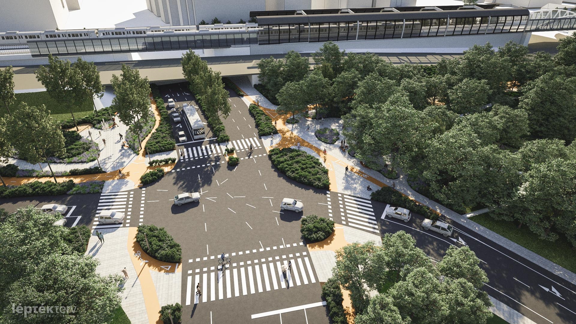
Bartók Béla street - Hamzsabégi street- Tétényi street meeting (Source: Vitézy Dávid / Facebook)
This entire area could become a contiguously landscaped, pedestrianized and bicycle-friendly corridor in the future, with traffic relief where needed. A special task at the intersection of the main roads is the creation of humane, livable, green and urban settlements, whether we are thinking of the Bartók Béla street junction, Csonka János square or the area under the Buda end of the Rákóczi bridge.
For the first time in the history of BFK, an organized community planning is happening, Vitézy emphasized. Representatives of the residents, those interested and the local council of Újbuda met the designers five times from July to September last year.
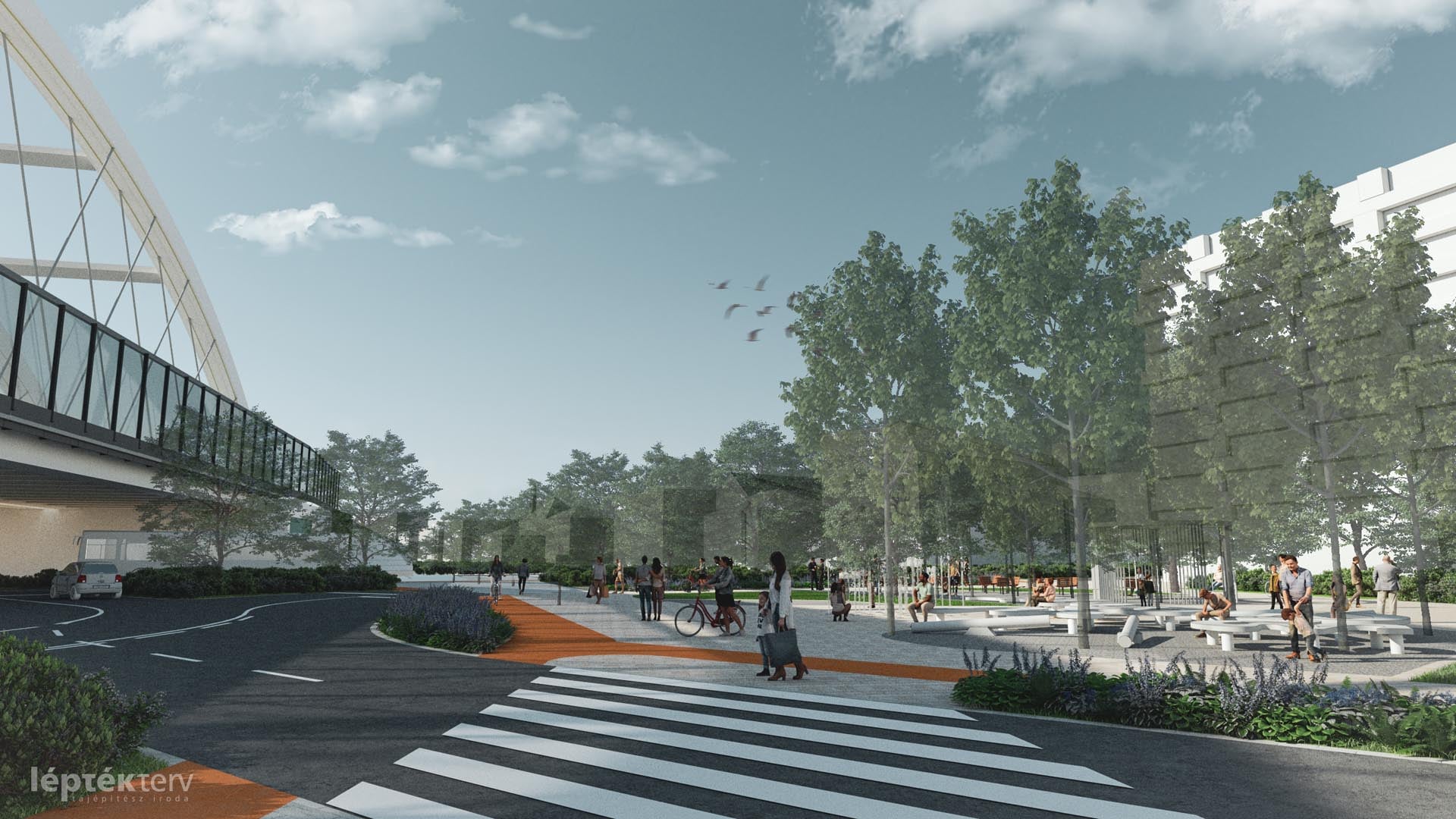
New public space at Bartók Béla street - Hamzsabégi street - Tétényi street junction (Source: Vitézy Dávid / Facebook)
The participants discussed some of the details of the plans together, and the result is taken into account by the designers when making the plans.
At yesterday's online forum, sketches and study plans of landscape architecture created with the help of community planning were presented. Final plans are expected by the end of the year. During the planning, the goal was to create self-sustaining, natural areas with the largest possible green areas, natural coverings, and water-permeable surfaces for healthy water management. Where possible, fewer paved surfaces will be created than at present.
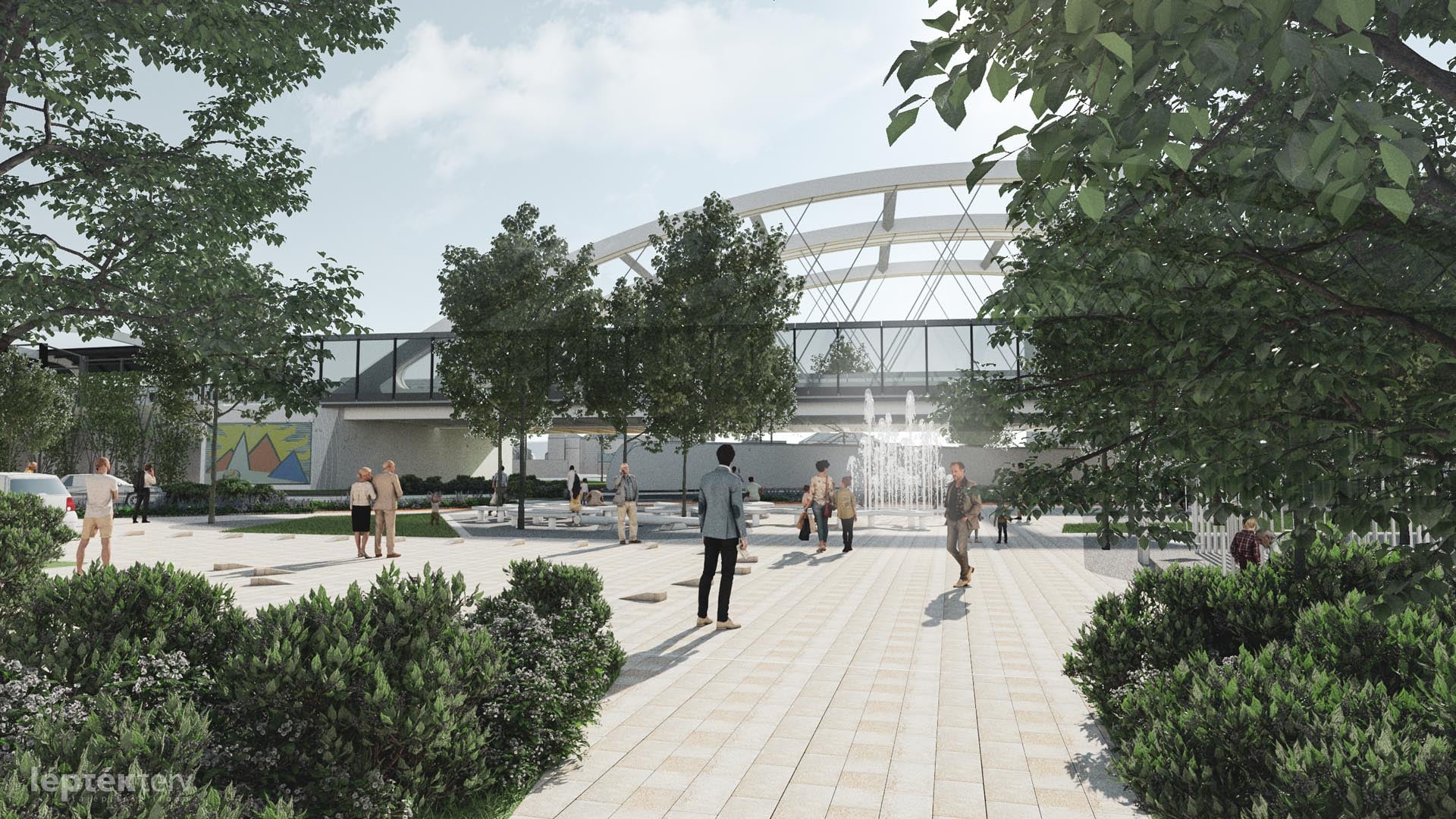
The area of the Budafoki street - Bogdánffy street junction (Source: Dávid Vitézy / Facebook)
According to Vitézy, the participants made a number of suggestions that were incorporated into the plans now presented. For example, contrary to previous ideas, the locals asked for the extra features to be concentrated in certain areas, but also to be simply green, grassy, wooded areas.
The planning was created under the direction of the Budapest Development Center and Nemzeti Infrastrukúra Fejlesztő Zrt., With the involvement of Újbuda, the Budapest local council and the Budapest Transport Center.
Cover photo: Visual plans of the Újbuda green corridor were presented (Source: Dávid Vitézy / Facebook)


")


