
Budapest was founded in 1873 by the unification of Pest, Buda and Óbuda. It did not include Újpest, Békásmegyer, Albertfalva or Pesterzsébet, although these settlements were connected to the capital by a thousand threads. One of the city's manufacturing centres was established in Újpest, and it is no coincidence that very early on, from 1866, a horse-drawn railway connected Újpest to inner city Budapest, while other agglomeration settlements were connected to the capital by suburban railway lines (HÉV) from the 1880s.
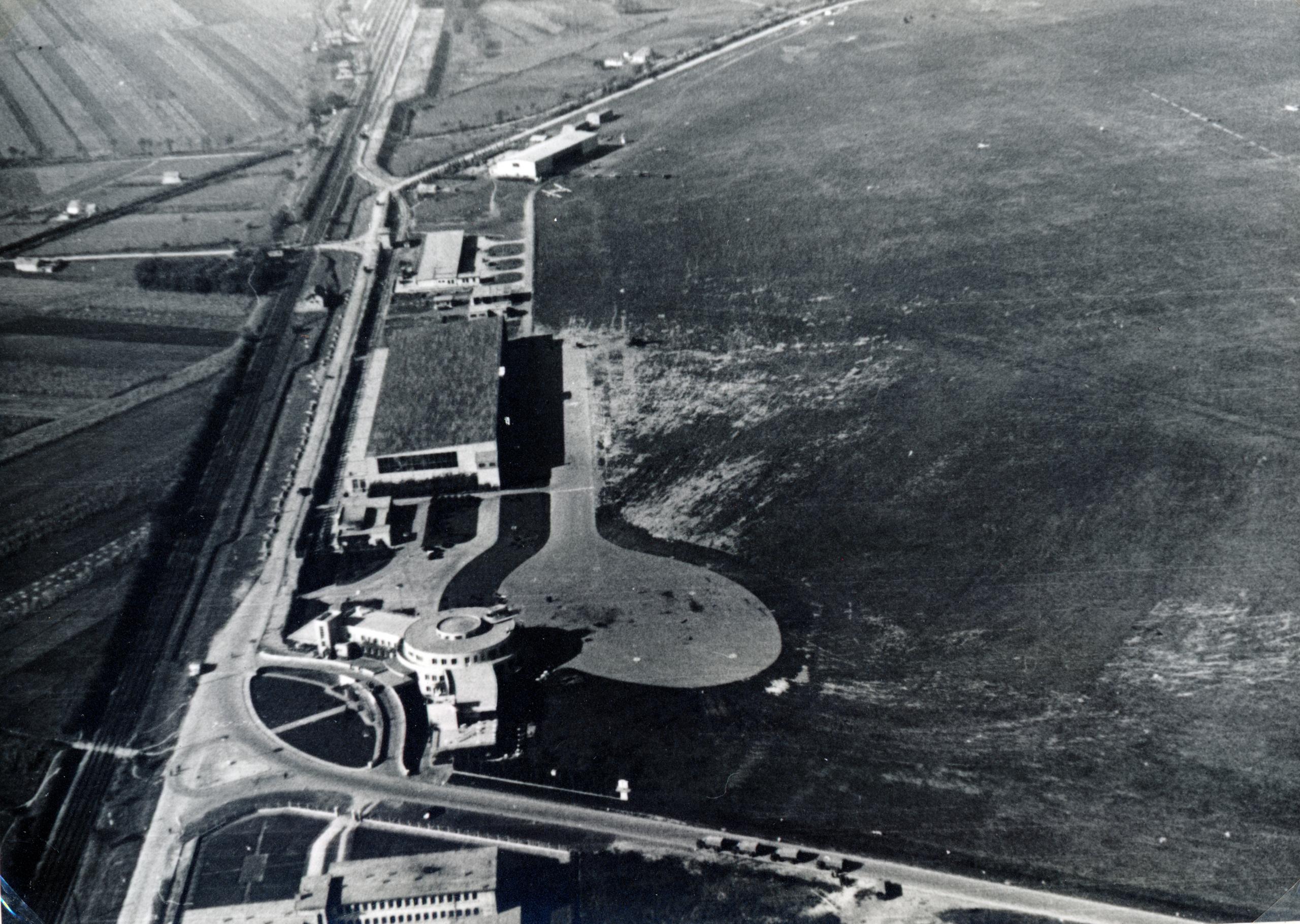
The Budaörs airport did not originally belong to Budapest (Photo: Fortepan/No.: 163868)
Already at the end of the 19th century, the idea arose that the surrounding settlements should be annexed to Budapest. Despite the fact that this was first formulated by the County of Pest, Budapest was still afraid of the increase in costs at that time. At the turn of the century, the situation had already changed, Budapest's leadership advocated expansion because they realised that the benefits that come from the larger city were far greater than the expected costs. Residents of the surrounding settlements also largely used the capital's infrastructure, while their tax revenues did not go to the capital. Pest County, on the other hand, was already against it at the end of the 19th century, partly due to prestige and partly due to the loss of income.
![]()
Manó Kogutowicz's map of Budapest from 1908 (Source: Wikipedia)
The first steps were delayed by World War I. The situation did not change between the two world wars either, although the city border changed slightly, for example, the area of the Budaörs airport was annexed to Budapest, but due to the unification dispute between the county and the capital, no major steps were taken until 1937.
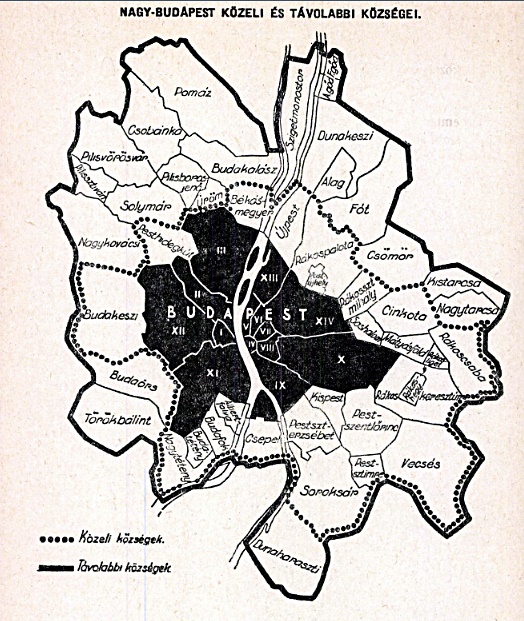
Near and far settlements of Greater Budapest (Photo: Dr Mihály Haltenberger: Settlements of Greater Budapest, City Review, Issue 7-8 1947)
At that time, in 1937, the National Assembly adopted a new urban planning law, which at the same time extended the authority of the Budapest Public Works Council (FKT) beyond the borders of Budapest. However, the law did not regulate exactly which settlements the Public Works Council's authority covers, this was stated in decree 33/1938 BM, which entered into force on 1 February 1938:
"From the point of view of the provisions of Article 6 of the 1937 Law on Urban Planning and Construction, the area around the capital city of Budapest includes: Újpest, Rákospalota, Kispest, Pestszentlőrinc, Pestszenterzsébet and Budafok county towns, as well as Pestújhely, Rákosszentmihály, Sashalom, Mátyásföld, Cinkota, Rákoskeresztúr, Rákosliget, Rákoshegy, Rákoscsaba, Vecsés, Pestszentimre, Soroksár, Csepel, Albertfalva, Budatetény, Nagytétény, Pesthidegkút and Békásmegyer settlements."
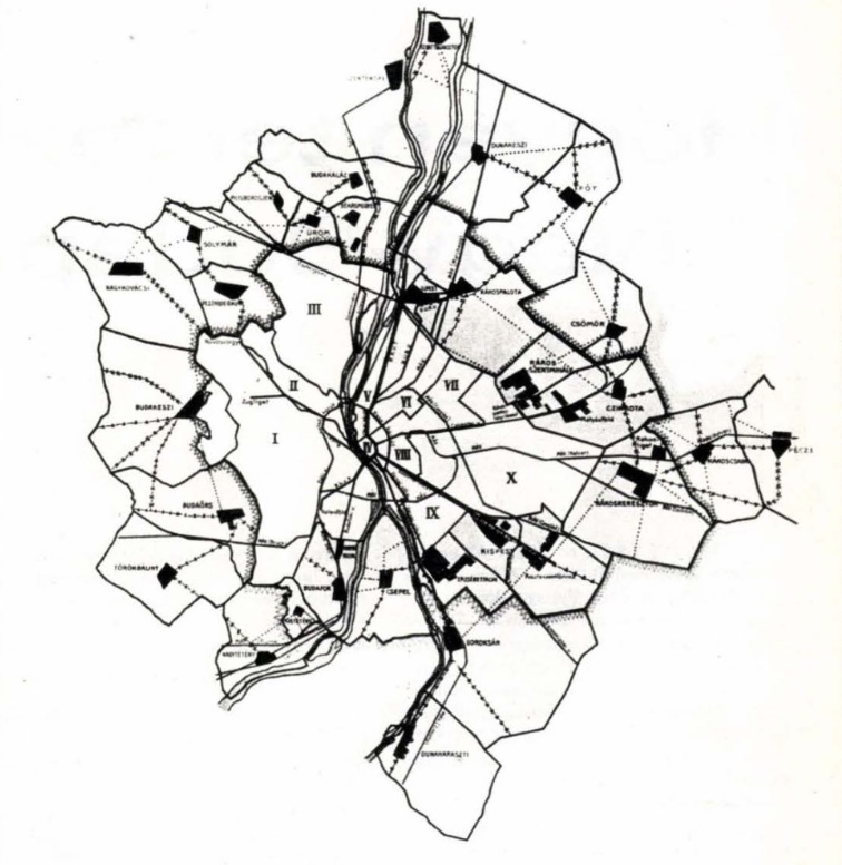
Ferenc Harrer's city unification proposal in 1905 (Source: Budapest, June 1979, Dr József Szaniszló: How was Greater Budapest planned?)
As can be seen, these towns and settlements, with the exception of Vecsés, are still part of Budapest today. Article 6 of the 1937 law, also cited in the decree, was actually about urban planning, within the framework of which the jurisdiction of the Budapest Public Works Council was extended to the Budapest area, and the competence of the FKT was also changed. Based on the authorisation of the law, it was given the right to establish regulatory plans, general and detailed plans, so the decree actually determined which settlements the Budapest City Public Works Council are responsible for in terms of the planning and regulatory plan.
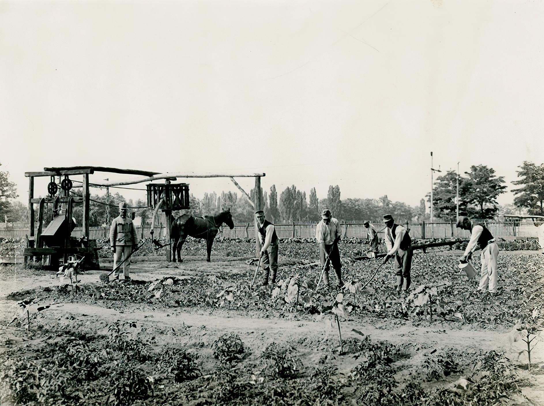
Rákosszentmihály, the military garden in 1915 (Photo: Fortepan, National Széchényi Library)
However, the development of Greater Budapest received a new impetus with this decree. In the same year, 1938, the Hungarian Institute of Public Administration conducted in-depth investigations into the extent to which the settlements around Budapest have an urban image or to what extent their population can be considered to be agricultural.
What did this mean in terms of numbers, how much did the powers of the Public Works Council increase? The area of Budapest in 1938 was 194.2 square kilometres, but this has then been expanded by another 340 square kilometres. In terms of population, the ratio was exactly the opposite, since the population of Budapest at that time already exceeded 1 million people, while 447 thousand people lived in the surrounding settlements named in the decree.
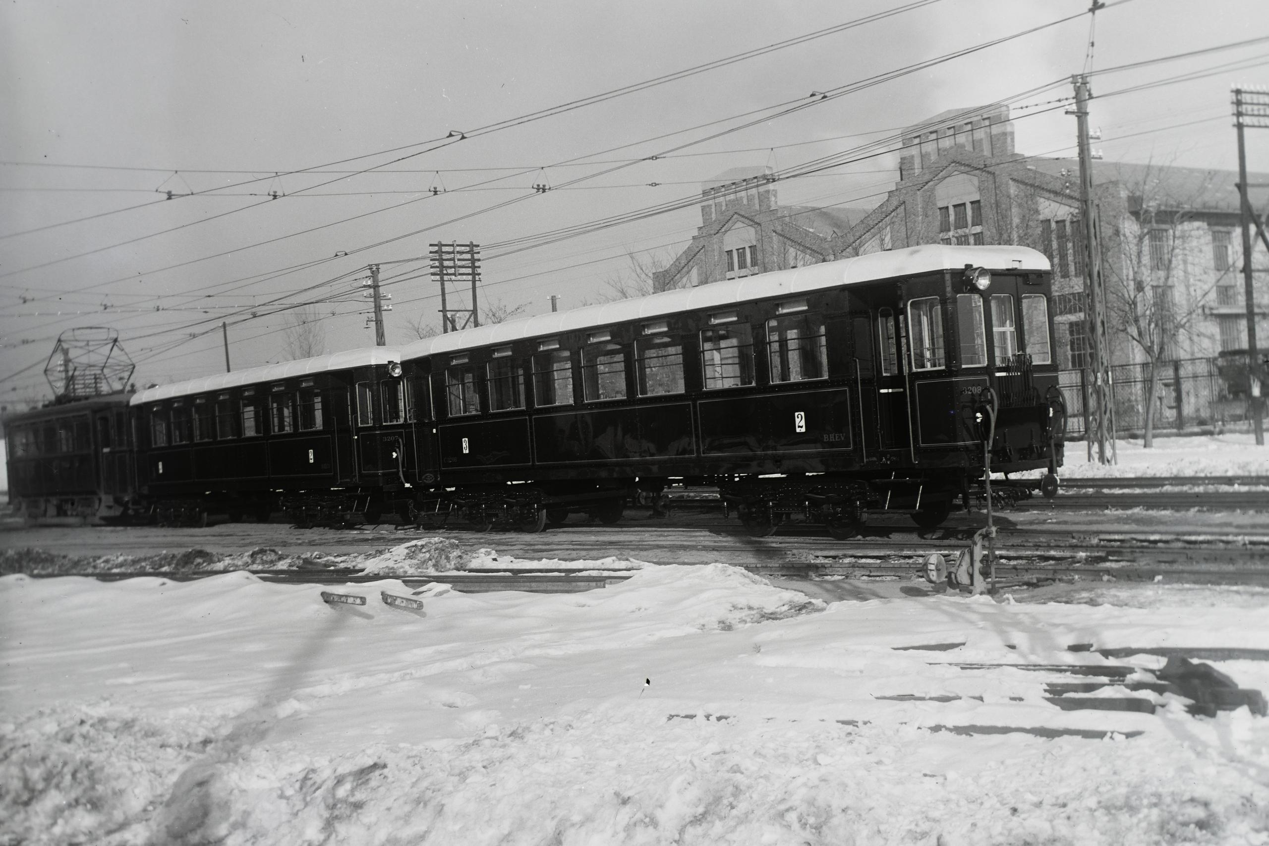
The HÉV train for the Budafok line in 1928 (Photo: Fortepan, Th Hungarian Museum of Science, Technology And Transport/Archive/Negatives/BHÉV collection, inventory number: 32526)
In the 1940s, serious plans were made for further city unifications, and a thorough assessment was made as to which settlements should be annexed to Budapest and which ones should not. The idea of Greater Budapest, on the other hand, was realised in practice in more and more places, many decrees were issued in which provisions were made about the Greater Budapest region. However, there was no consensus as to which settlements were included in Greater Budapest, as each provision considered something else to belong. József Gőbel wrote the following in his article "Great Budapest in the light of decrees" published in the 1946 edition of the City Review:
"In 1940, for example, there were twenty-seven types of "Greater Budapest" from the point of view of wage determination alone (...). Even according to the currently valid legislation, we can still distinguish the following no less than ten types of Greater Budapest"
During World War II, there was again no way to define the new borders of Budapest. The decision to unify the city was only made in 1949, although this was already permeated by the centralising communist state system, as it abolished local self-determination and introduced the council system. The new power attributed all the merits of the town unification to itself and saw the oppression of the workers in the failure to unify the town. However, the development of Greater Budapest was a long, half-century process, one of the important elements of which took place 85 years ago.
Cover photo: Budapest skyline in 1892 (Photo: Fortepan/Budapest Archives, Reference No.: HU.BFL.XV.19.d.1.05.148)


")


