

All over the city, memorial plaques and signs showing the water level remind us of the great flood of 1838. Indeed, the flood had a lasting effect on Pest in several respects. Buda was less affected at the time, but 38 years later, the right bank of the river broke its banks, not that Pest avoided its wrath.
“After 20 February, the boats were kept ready in the 1st, 2nd and 3rd Districts (Buda and Ó-Buda). In the 5th District, the area known as Vizafogó – only 18–19 feet above the water level – was evacuated, The water level rose constantly, about 1 inch (2.6 cm) per hour. Towards 10 a.m. on Wednesday morning, the ice moved again at a water level of 17 feet 2 inches (543 cm), but after half an hour, it stopped. This was when the first signals were given – cannons fired every 3–5 minutes, informing the low-lying areas in the first three District that danger was approaching. At that time, the water was flowing over the bank in Vizafogó, where the last rescue measures were underway. Boats were ready everywhere, and some divisions of the army were ordered into action.
Reported Prime Minister Kálmán Tisza to Franz Joseph regarding the flood on 29 February 1876. Only a section of the long report (from a study by Dr László Nagy entitled 140 éve voltak az 1876. évi árvizek) can be quoted here as the Prime Minister described in detail how Békásmegyer and Óbuda, as well as a part of Pest, were underwater. Fifty-two houses collapsed in Újpest, but fortunately, no human lives were lost.
The flood of 1876 was also unique because the winter and spring floods happened almost simultaneously. Winter floods are caused by ice flows: floating ice becomes stuck and creates a dam in the river (as happened in 1838), while the spring floods are caused by large amounts of water flowing down from the mountains as snow melts.
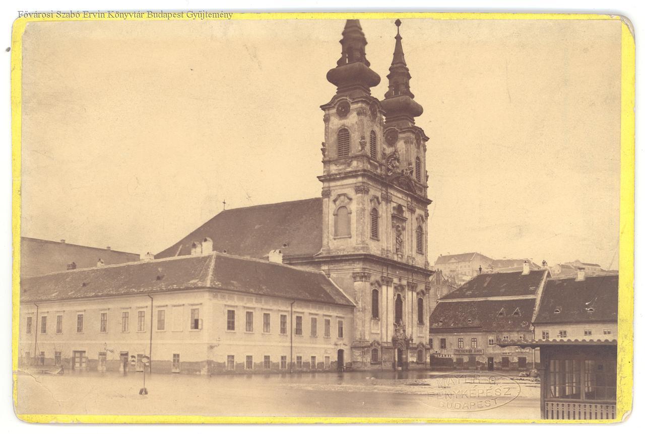
Present-day Batthyány Square during the flood of 1876 (Photo: FSZEK Budapest Collection)
The same year saw severe floods all over the country, on both the Danube and the Tisza.
The trouble began in December 1875, when ice flows lasted for 5-6 days. Due to the narrowing of the river and the closure of the Soroksár Danube, no ice barrier formed near Budapest, as happened in Lágymányos in 1838. As a result, the river did not break its banks in Budapest, only further south, towards Ercsi. Even this dam had such a significant effect that it raised the level of the river in Budapest.
The situation was further exacerbated by the start of the next flood caused by sudden warming.
The water level in Budapest peaked at 867 centimetres on 9 March. While 60 centimetres lower than the 1838 peak, the flood could have caused enormous damage. The flooded area was smaller than in 1838 and mainly concentrated in Buda. Fortunately, the authorities acted in time, evacuating a total of nearly 20,000 people.
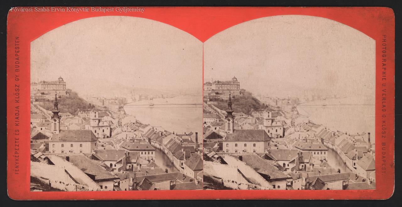
Flooded Buda in the photograph by György Klösz (Photo: FSZEK Budapest Collection)
Nevertheless, the river wreaked havoc: flooding Óbuda, the parts of Buda on the riverbank, and breaking its banks in Csepel. Several homes were washed away in Újpest. In Buda, the river did not break over the embankments and dams but burst up through the sewers. This led to some low-lying areas, today's Fő Street, Batthyány Square and Óbuda to be flooded.
Why was there no major damage, even though the water level was barely below that of 1838?
One explanation is that the city learned from the 1838 flood. For example, new building rules were adopted that did not allow living spaces to be built under the peak water level measured in 1838. Preparations were also made to protect the city as a whole from floods. In the 1860s, the respected engineer, Ferenc Reitter, developed a flood prevention scheme, in which he proposed narrowing the river to ensure the ice could not stop and raising the height of the riverbanks. In the footsteps of these plans, large-scale construction of the embankments began in the 1870s.
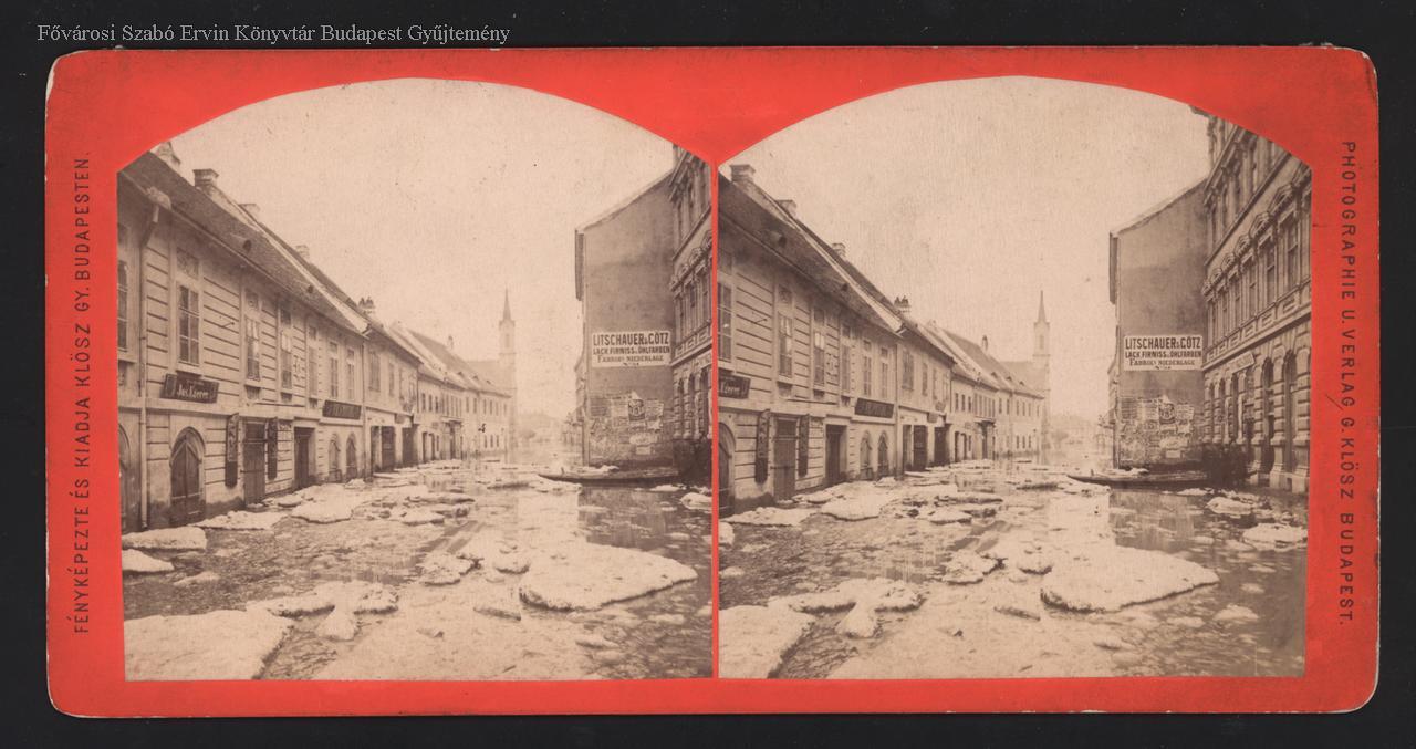
Fő Street, photograph taken by György Klösz (Photo: FSZEK Budapest Collection)
The embankments played two roles: they served as quays for boats and barges to load and unload and protect the river from floods. Most of the works were completed by 1875, at least on the Pest side, and Kopaszi Dam also completed, narrowing the river at Lágymányos. This was important because it was where the ice became stuck in 1938.
The city was thus much better prepared for the flood of 1876. The system served its purpose well, at a fundamental level, but areas for improvement were also identified.
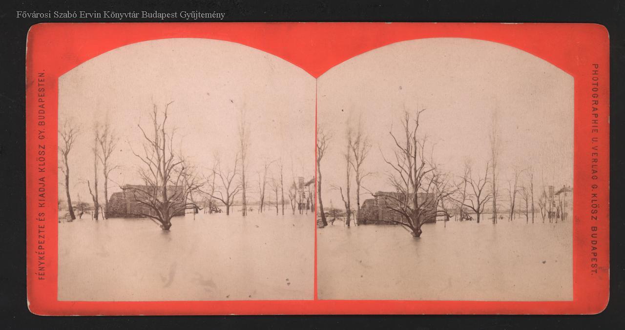
Margit Island underwater in a stereo photo by György Klösz (Photo: FSZEK Budapest Collection)
After the flood passed, the existing flood protection works and plans were revised and changed. The height of Kopaszi Dam and the Budapest embankments were raised by another 62 centimetres, and the decision to regulate other parts of the river was reached.
Budapest was practically ensured to be safe from floods with the additional work (which covered not only Budapest but the entire section of the river). And the flood defences were needed indeed. In 2013 the water levels surged to heights never seen before.
Cover photo: Buda under water (Photo: FSZEK Budapest Collection)


")


