
Róka Hill is the northernmost natural hill in Budapest, but few facts are known about it. Although a popular excursion destination for locals, its notoriety and popularity dwarfs that of the neighbouring Hármashatár-hegy [Three Border Mountain]. It is primarily the accessibility, the many exciting sights and the excellent panorama that are worth mentioning. The Kevélyek mountain range is also close to a more extensive exploration tour, but we are now focusing on exploring the Róka Hill, which is almost entirely on the administrative border of Budapest.
The easiest way to approach it is with the Szentendre HÉV. We have to get off at the Csillaghegy stop, and from here the red triangle sing takes us to the top of the mountain. The road is steep, we rise more than a hundred meters from the base of the station. By the way, the full route we suggest in the article is conveniently walkable in about four hours, but visiting all the sights mentioned can take almost a full day, given the darker winter days.
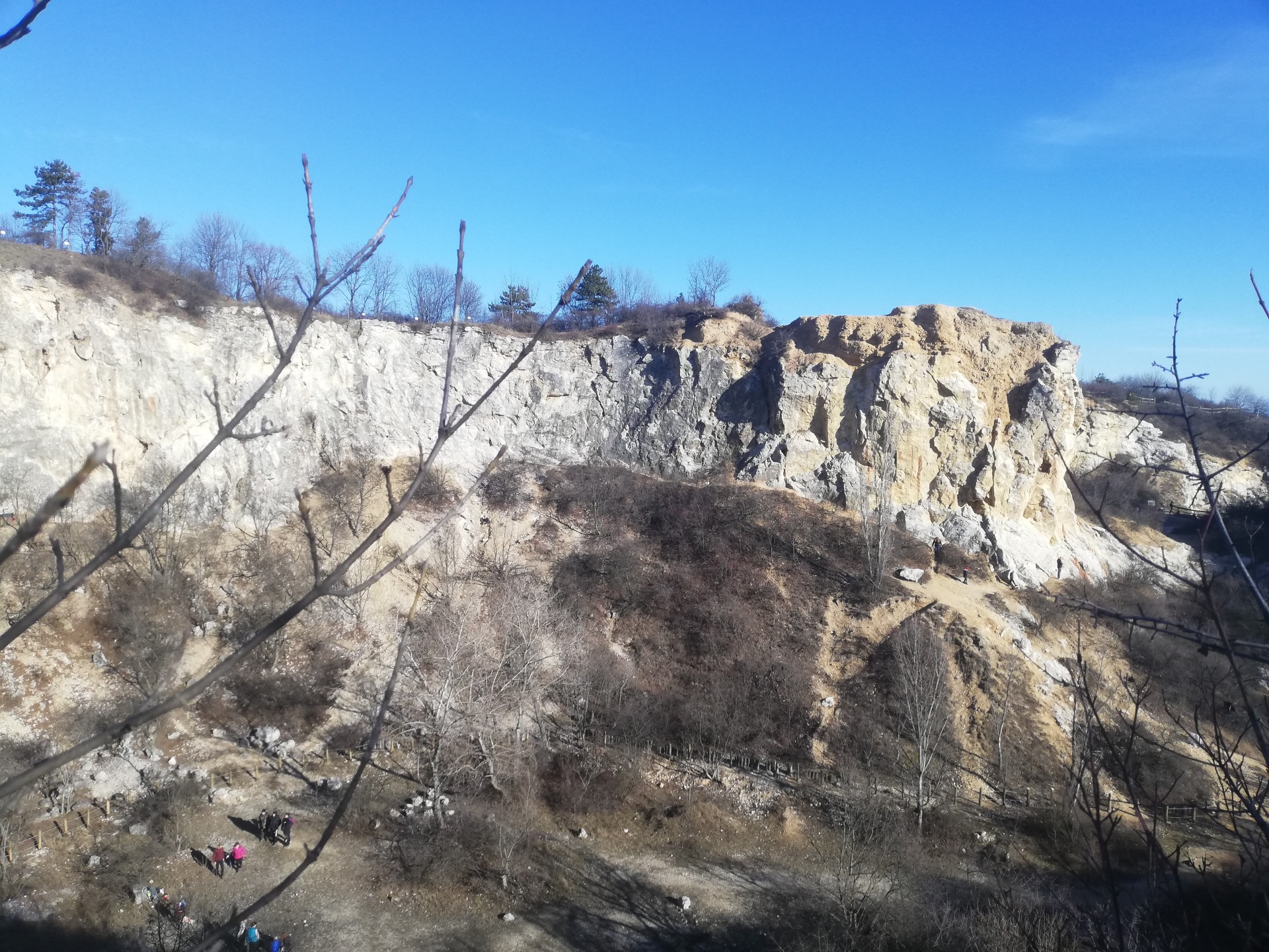
Really romantic landscape (Photo: Dávid Palotás / pestbuda.hu)
Prior to the establishment of Greater Budapest, the Róka Hill did not belong to Budapest; the border run in front of it to the valley of Csillaghegy on the ridge of the neighbouring Péter Hill. However, when Békásmegyer was annexed, the entire northern foyer of Róka Hill came to the capital, which was slowly urbanized in the second half of the 20th century. It is interesting that Csillag-hegy [Star Hill] does not exist, the origin of the name Csillaghegy dates back to the beginning of the last century, when the holiday resort next to the spa was named Csillaghegy. Thus, the situation arose that the Csillaghegy part of the city is in the valley, and Csillag Hill is not there, instead there is only Róka Hill, Péter Hill, Arany Hill.
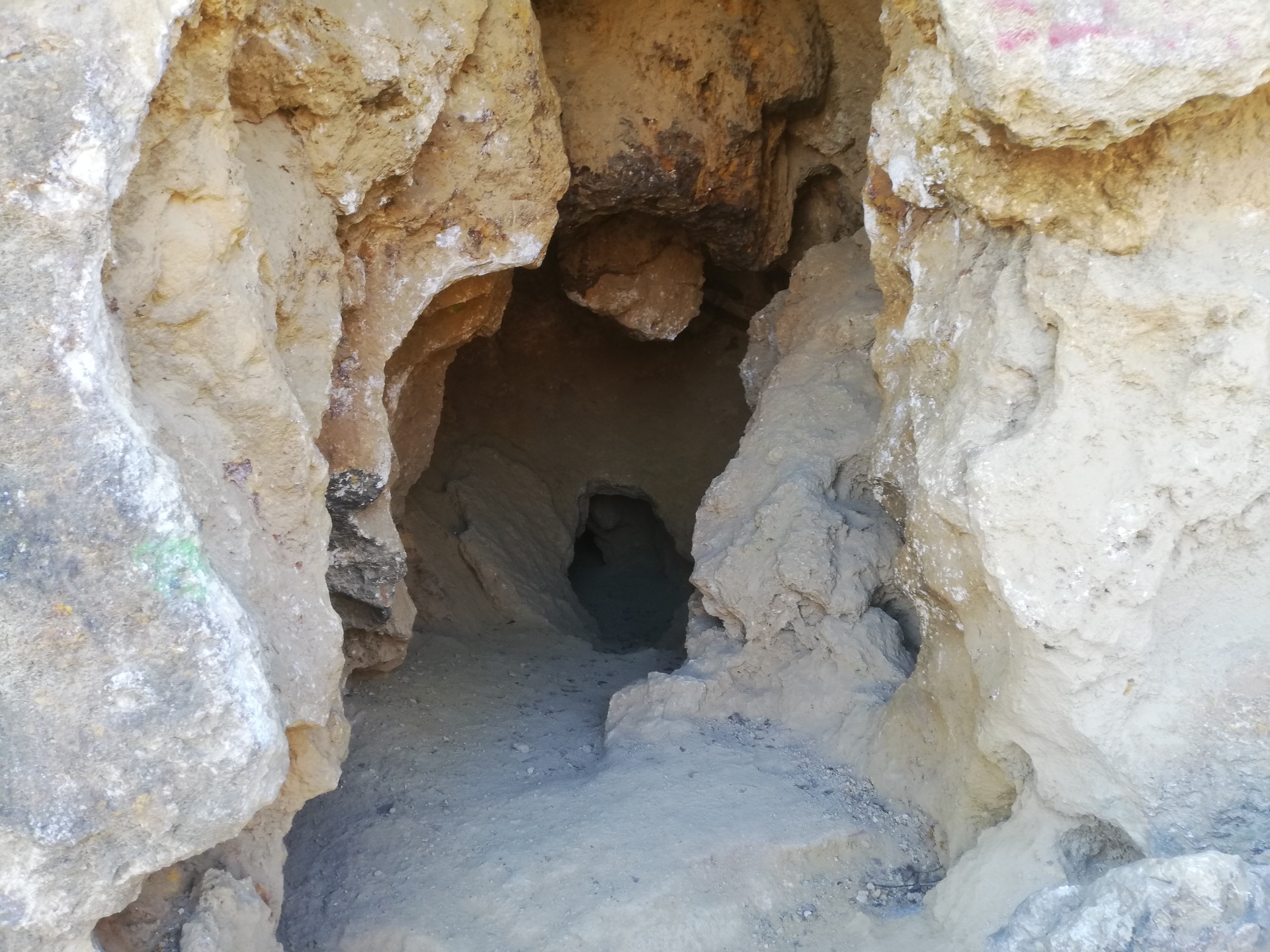
The interior of Róka Hill is a real tourist attraction (Photo: Dávid Palotás / pestbuda.hu)
So after we get off the HÉV on Csillaghegy, following the red triangle sign, a steep journey begins, but the journey to the mining pits does not take long in time or distance. There are also three main mining pits, it is now a nature reserve, and several valuable animal and plant species can be found in the area. There will be more educational trails starting here, we will be walking along the red T educational trail.
Several mining cavities have been established on Róka Hill over time, and although the ancient origin has not been proven yet, in the 19th century good quality limestone was mined during the construction of the classicist palace districts of Budapest. A significant percentage of the inner city buildings that stand today contain limestone mined here, because the mountain is made up of crystalline limestone with very good appearance and solid, straight strands. Geological and biological features are also indicated on the boards of the trail.
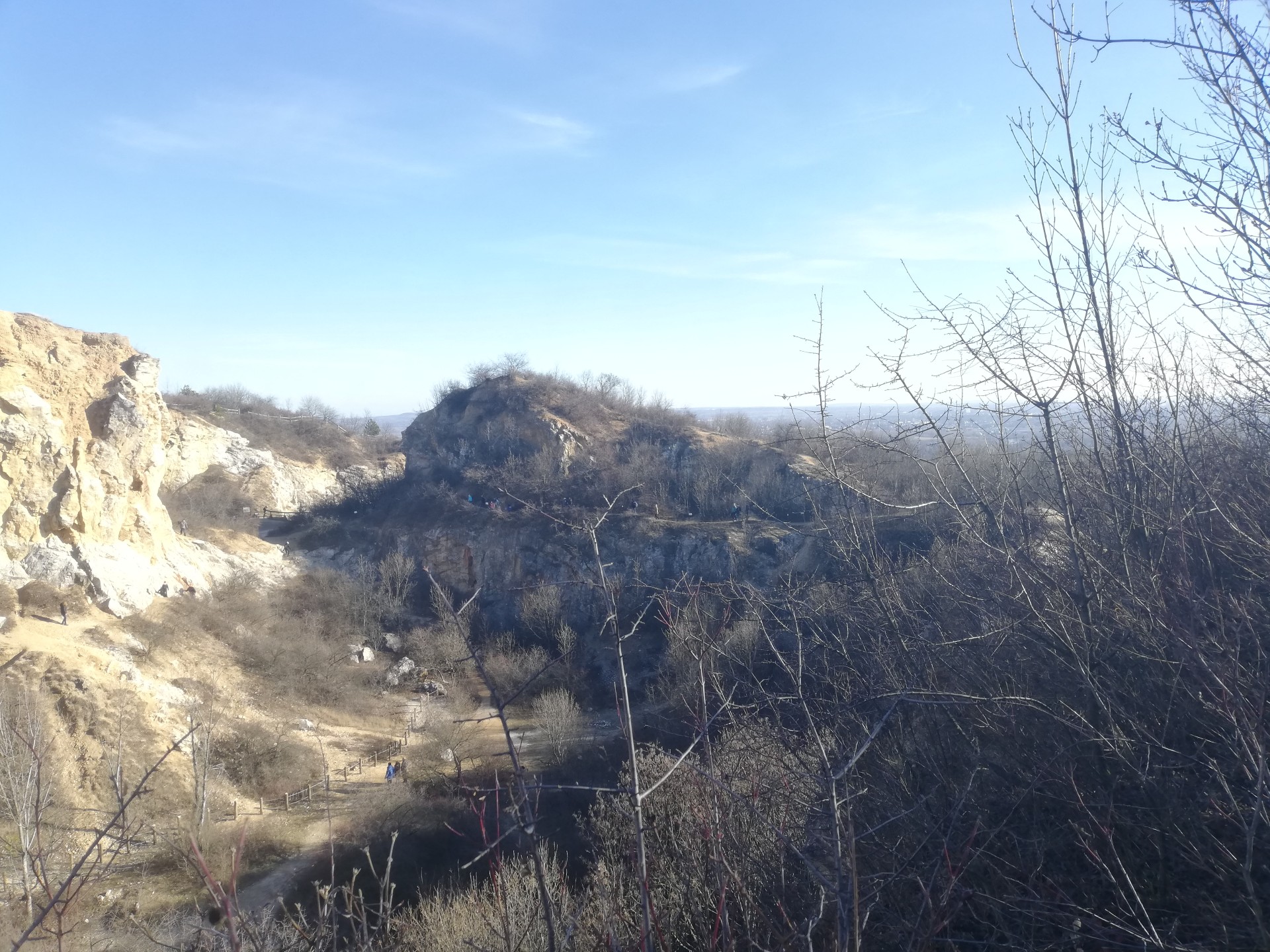
Looking at the landscape from the bottom of the mine cavity, we feel as if we are really in a miniaturized Grand Canyon. If nothing else, this sight is well worth the trip. For those who prefer comfort, we can tell you that from the parking lot next to the Üröm cemetery you can reach Róka Hill in a relaxed, one-kilometer walk.
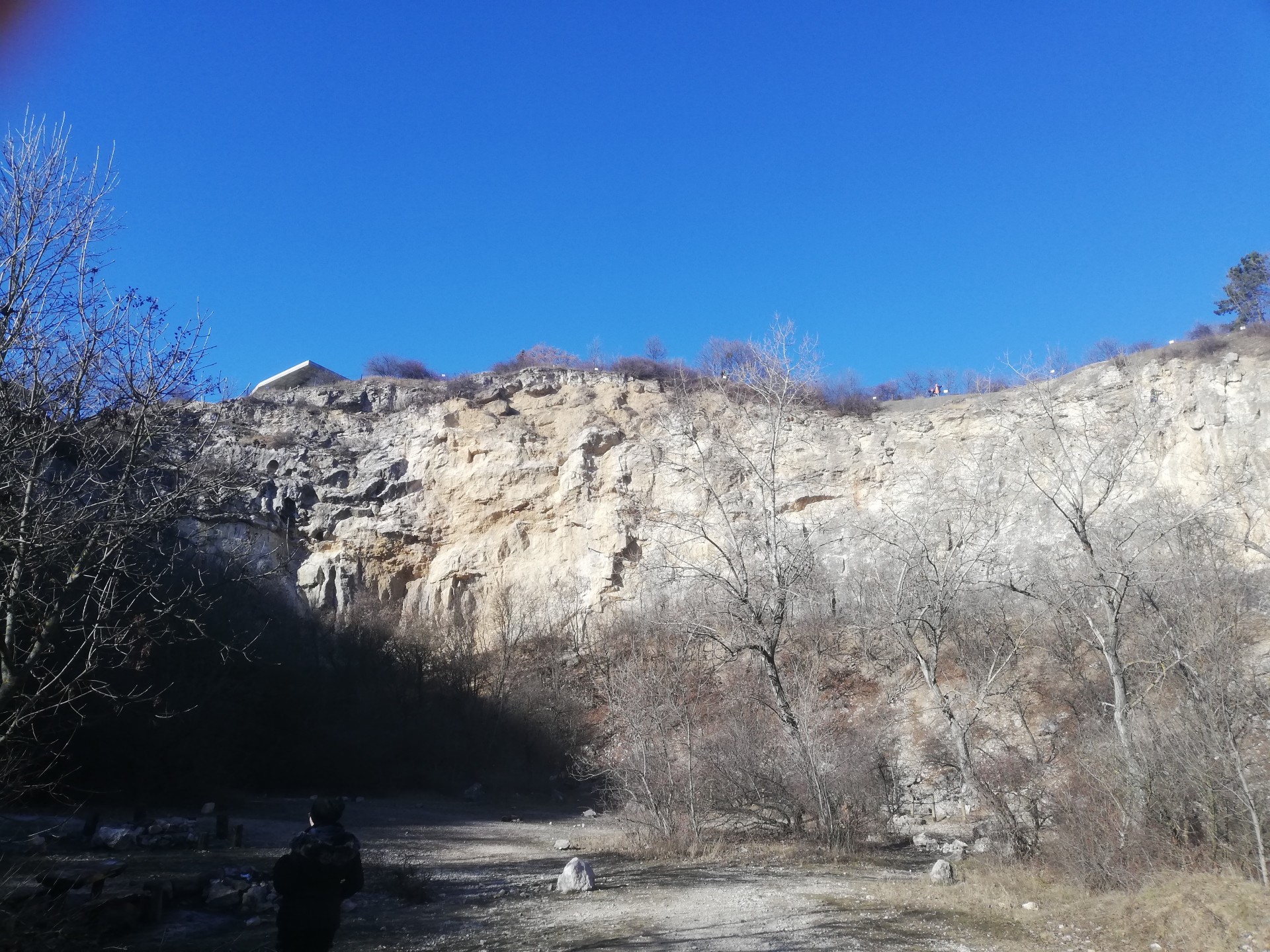
We can look into a lot of cavities (Photo: Dávid Palotás / pestbuda.hu)
The strange, water-carved or crumbling rock forms provide a truly captivating sight. There are many small cavities, cavernous depressions, passages formed by the waters of ancient times from the easily decaying limestone.
Many climbing routes have been created on the rock wall, making the place extremely popular with rock climbers in recent times. There are several fire sites at the bottom of the pit, the legality of which is questionable in terms of the protection of wildlife, but we did not see any prohibition signs when we were there.
Part of the climbing wall (Photo: Dávid Palotás / pestbuda.hu)
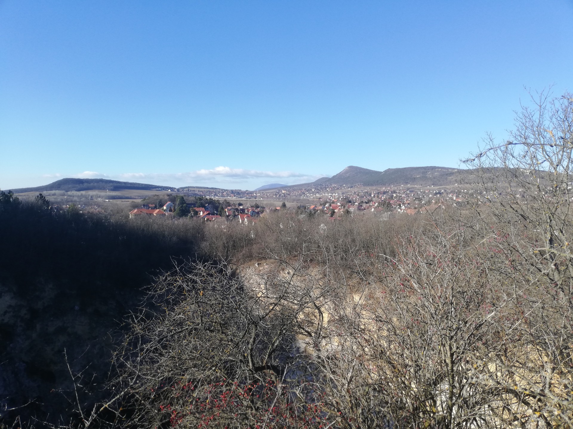
If you climb to the top of the hill, there are excellent views of the area in several directions and from several places: the Gödöllő Hills, the eastern part of the Buda Hills, the southern part of Pilis, the Buda Castle, and Gellért Hill. Looking towards the south-east and towards the Great Plain, the special situation is that only the houses that stand out from the city are visible on the horizon, which gives a very special experience. The fact that the hill is not really high in relation to its surroundings and that there is no topography to the south-east plays a big role in this.
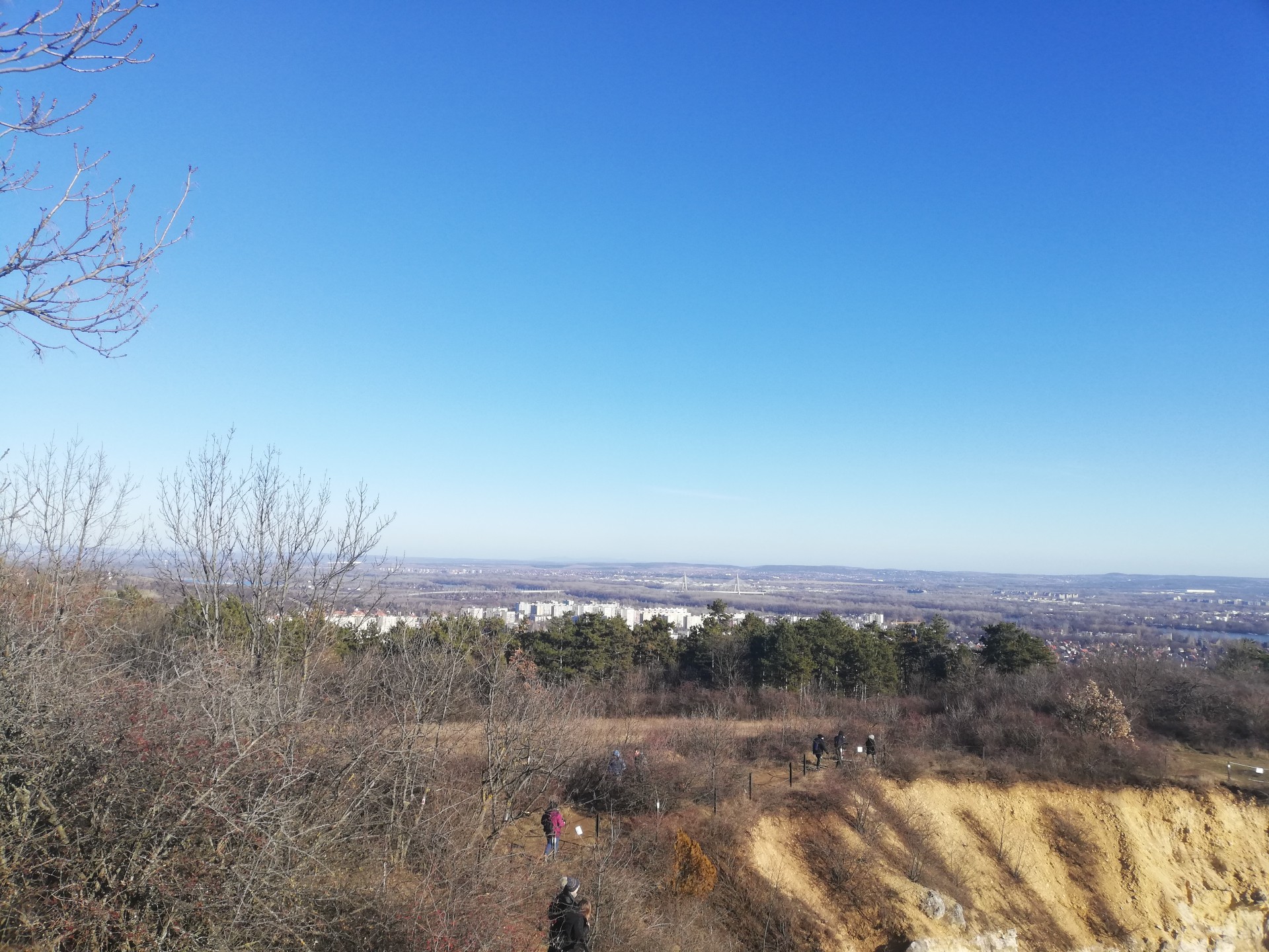
This sight shows the face of the city from an unusual angle (Photo: Dávid Palotás / pestbuda.hu)
The only, but unfortunately big enough negative of the whole Róka Hill is that it is almost completely surrounded by real estate, which pretty much degrades the perception of the natural environment. The terraces of the houses hang almost almost above the pit, raising significant ethical concerns.
If you have been staring at the many nearby and distant sights, we should turn onto Rókahegyi Road and head down a bit. We have to describe the route in more detail, because the signs are incomplete: to the right, you have to turn right into Kárókatona Street, and from there to the second street on the left, Holló Alley. There will be a forest at the end of this, but a wide path will begin at the end of the forest. The road immediately splits in two, if we go to the left, then with a small detour we get to a World War II watchtower, it is worth seeing, it is hardly visible from the trees. Not far from here another World War II remnant, an ammunition booth can also be found.
We recommend that you use your smartphone for locating this, as nothing is indicated on the spot. If we go back to the fork, we should continue our journey straight now, as if we had already turned right when we entered the forest. Here we come forward on a long road going through pine forests. It is already the ridge of Péter Hill, which is now and was also in the 19th century the administrative border of Budapest. You can also see the inscription on the stones marking the city limits placed every few hundred meters. Some are in very good condition, with very nice written fonts. Unfortunately, the vandalism can be seen here as well, there was some scribble or obscene inscription on each column.
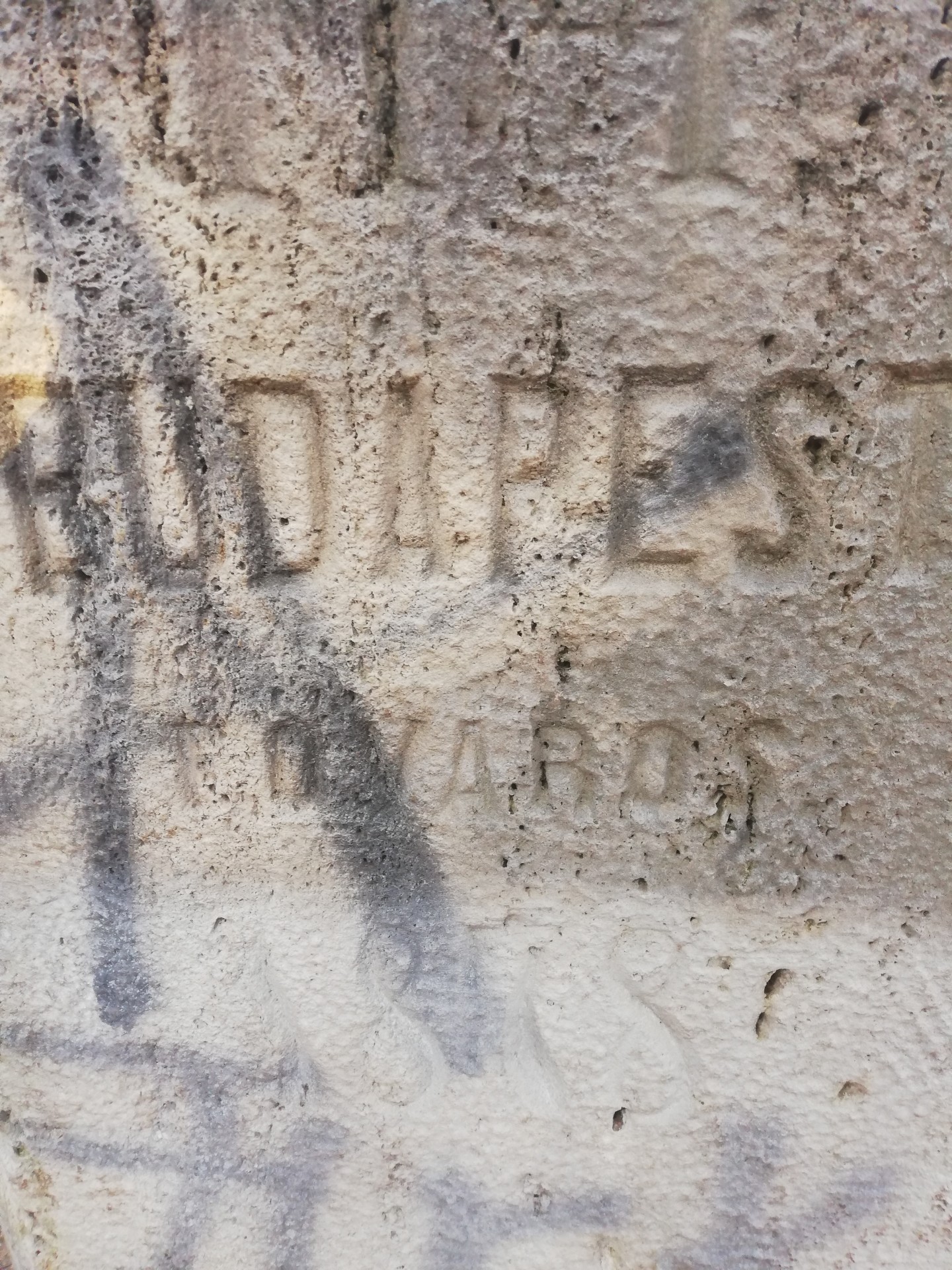
A part of one of the columns, unfortunately the graffiti did not allow us to show in all its splendour the stone marking the contemporary city limits (Photo: Dávid Palotás / pestbuda.hu)
The study path turns slightly sloping to the right towards Üröm, then we reach a fenced part on the left. Here, too, there is an earlier mining cavity with a smaller lake in the middle: the Csókavár quarry. However, it is completely closed to visitors, so we do not encourage the dear Reader to climb on the fence, but whoever has a drone can do a careful try, because the small pond in the pictures is very spectacular.
There is a hidden little pond down at Csókavár (Photo: Dávid Palotás / pestbuda.hu)
From here, however, the Kisdomb Nature Reserve, already in the area of Üröm, is barely two hundred meters away. A typical example of the so-called desert grass slope steppe. It is also worth a visit in the spring, because the flowering of protected plants is always a breathtaking sight. Ranunculus illyricus, orphan maidenhair, inula helenium and sternbergia lutea can also be found in the area, which are unfortunately rare in the Buda Hills.
A part of the Kisdomb Nature Reserve (Photo: Dávid Palotás / pestbuda.hu)
Let's walk further down Kálvária Street, then turn right onto the busy Dózsa György Road. We will soon reach the Calvary in Üröm, a small, sloping hill, but in the end the stone crosses are beautiful even in their ruined condition.
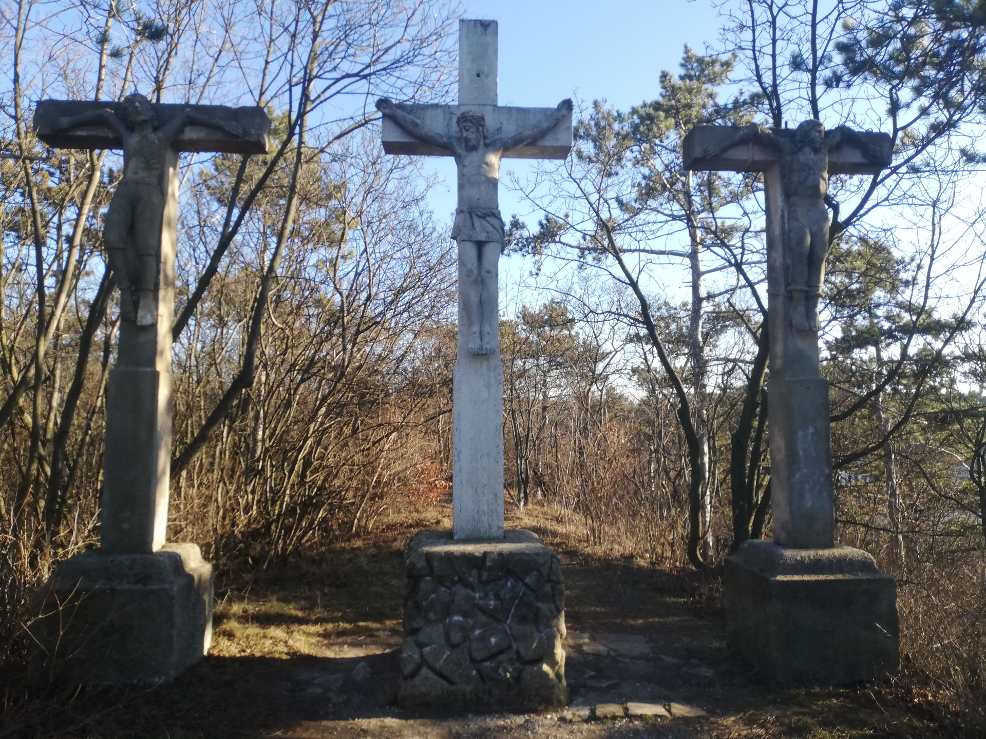
In this way, the stone crosses fit into the landscape more beautifully than if they were new (Photo: Dávid Palotás / pestbuda.hu)
On the rest of the way we will return to Róka Hill, continue on Dózsa György Road, then right up the church on Fő Road, which will take us out of Üröm and take us to the Csillaghegy station.
During our trip we could visit the sites related to each episode of the Budapest past, three nature conservation areas, a small agglomeration settlement, and a mountain with a beautiful panorama. For those who still feel like another walk, we recommend visiting the Pogány-torony [Pagan Tower} at the eastern end of the Arany Hill. The Arany Hill is a limestone hilltop stretching east-west, similar to the Péter Hill, just a little further south.
We can only have one request after exploring the area: don't build it in even more.
Cover photo: Róka Hill (Photo: Dávid Palotás / pestbuda.hu)


")


