
If today's people were to go back to 1848, they would not really recognise the Budapest of today in Pest and Buda at that time. First, they were separate cities, and they were much smaller. In Buda, there were only houses in the area of the Castle, Víziváros and Tabán, and in Pest, today's Inner City, i.e., the 5th District, and the inner parts of Józsefváros and Ferencváros constituted the city itself.
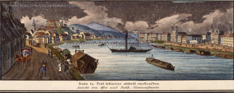
The bank of the Danube in an engraving by Carl Vasquez, 1837 (Source: FSZEK Budapest Collection)
Among the characteristic buildings of Pest, the churches had been standing for centuries, except for the Basilica, since its construction was decided shortly before. The Inner Ring Road also existed, and the Hungarian National Museum was also in its place, although Sándor Petőfi did not recite the National Poem on its steps (the memorial plaque on the site about the recitation is wrong). There was also the Rókus Hospital, although it was still on the outskirts of the city at the time. The building block of today's City Hall also stood there in the inner city as a barracks, this was the Károly Barracks. Among the parks and gardens, the City Park and the garden behind Ludovika, today's Orczy Garden, could also be visited. There was a market place on the site of today's Erzsébet Square, but houses stood on the site of Deák Square.
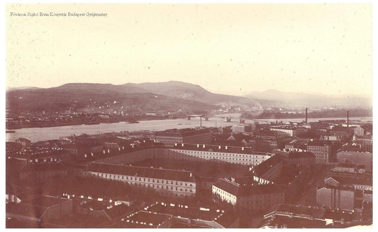
The New Building was also standing in 1848, even at the end of the 19th century, when this picture was taken (Photo: FSZEK Budapest Collection)
The street network in most parts of the city was similar to today's, Üllői Road, today's Rákóczi Road or Bajcsy-Zsilinszky Road were considered important traffic routes even then, although, with the exception of Üllői Road, these streets were called differently, since Rákóczi Road was Kerepesi Street, Bajcsy-Zsilinszky Road was known as Váci Road by the people of that time. However, in Pest in 1848, even if we looked for Andrássy Avenue, there was only a small street in its place, there was no sign of the Outer Ring Road, empty areas were there, elsewhere, in Józsefváros (of which Erzsébetváros was still a part) there were low buildings. Within today's Inner Ring Road, a tangle of small squares and streets stood on the site of Kossuth Lajos and Szabad Sajtó Street.
Only a small part of the streets was paved, the townspeople mostly drove in mud and dust, and those who did not have money for a rental or their own carriage, or did not have a horse, could walk or get on the omnibuses, which ran from 1832.
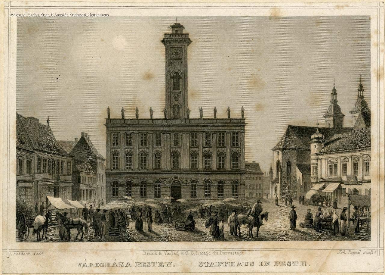
The old Pest Town Hall in the 1850s (Source: FSZEK Budapest Collection)
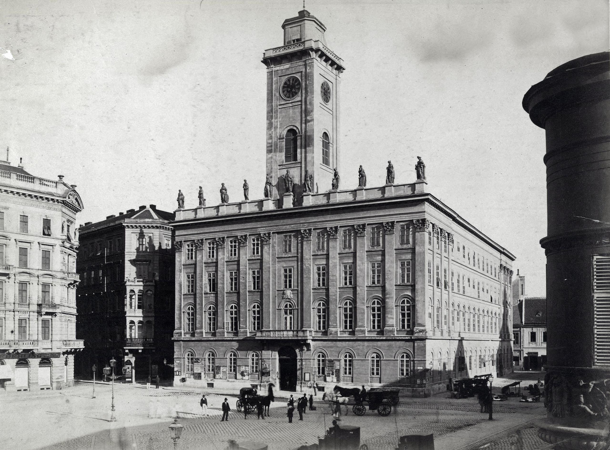
The old Pest Town Hall at the end of the 19th century (Photo: Fortepan/Budapest Archives, Reference No.: HU.BFL.XV.19.d.1.06.017)
There were some buildings of impressive size or great importance in Pest, which can be no longer seen. On the northern edge of Lipótváros stretched the huge New Building, which was intended as a home for invalids, but in 1848 it served as a barracks. The huge, square behemoth, studded with large, square buildings at its corners, occupied the entire present-day Szabadság Square and the surrounding buildings.
To the north of it were military warehouses and factories all the way to the railway station, which stood on the site of today's Nyugati Railway Station, but much further south, its facade facing the city was on the line of today's Jókai Street. The Pest Town Hall, with its spectacular tower rising above the houses, was a much smaller-scale building, and it stood on the corner of today's Váci Street and Szabad Sajtó Road.
The connection between the two banks was the pontoon bridge that crossed the Danube in front of today's Vigadó. Here stood the old Vigadó, behind which the building of the German theatre looked towards today's Vörösmarty Square - which was then called Színház Square. An elegant row of houses stood on the banks of the Danube, which - together with the Vigadó - in 1849 fell victim to the destruction of Heinrich Hentzi, the defender of the Castle, which was besieged by the troops of Artúr Görgei.
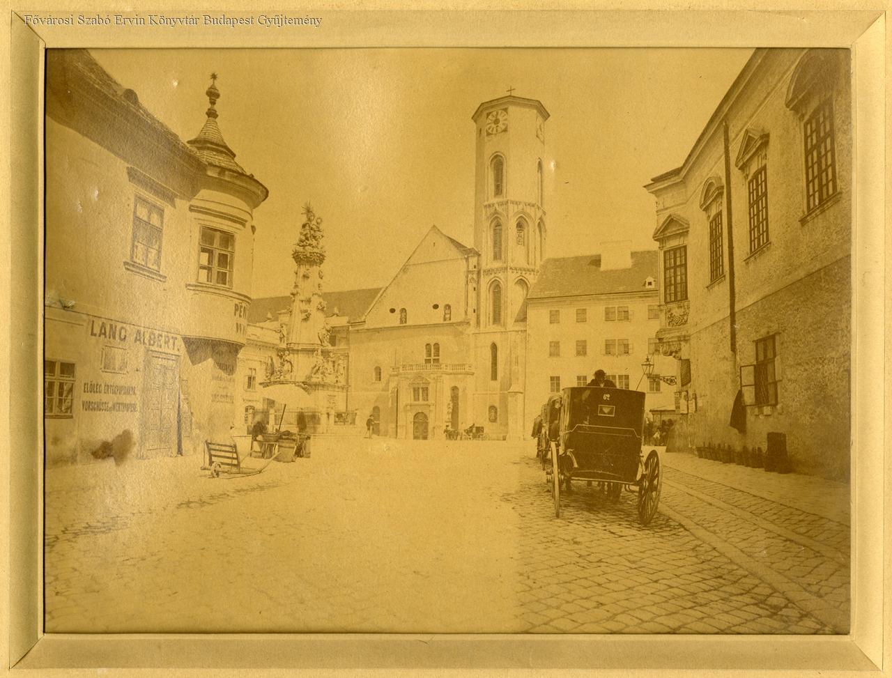
The Church of Our Lady (Mátyás Church) before its reconstruction in the second half of the 19th century (Photo: FSZEK Budapest Collection)
The banks of the Danube looked completely different. The bridges could not be seen yet, except for the half-finished Chain Bridge, where the chains were just being installed. The small Festő Island still existed to the south of Margit Island, which is somewhat smaller than it is today, while in the south, under Gellért Hill, the Danube widened, reaching a width of one kilometre in the area of today's Rákóczi Bridge. Csepel Island was surrounded by two branches of the Danube of almost the same width.
Today's embankments were nowhere to be found, the riverbank was an unregulated, muddy, flat area, anyone could easily walk down to the shore, where steamships stood, goods were unloaded here, and travellers got on and off the ships.
On the Buda side, on Castle Hill, a much more modest royal palace dominated the picture, and many well-known buildings defining Budapest would not be there, since the Fisherman's Bastion did not yet exist, nor the Matthias Church could be seen in its present form in the Castle.
Below the Castle, a network of small, intricate streets snaked a decent distance from the walls, because it was not possible to build at the base of the Castle, as it was considered a military area. Of course, the Tunnel did not exist either, only plans were made for it, just as there were no traces of today's Clark Ádám Square or Hunyadi János Road, just as the Funicular did not run yet.
Apart from Castle Hill, the small houses and narrow streets of Tabán extended up to the side of Gellért Hill, the top of which was still occupied by the observatory, not the Citadella.
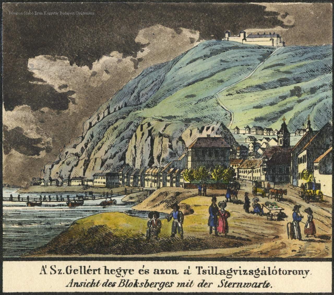
Gellért Hill and the observatory in Carl Vasquez's engraving, 1837 (Source: FSZEK Budapest Collection)
There were Turkish baths, the Rudas, Rác and Király, but in place of the Gellért Bath, there was another modest bath building, the Sáros Bath, popular among the poor and prostitutes, above which in the cave of the Gellért Hill, there were not yet a church, but cave dwellings.
To the north of the Castle, on today's Széll Kálmán Square, there was a clay mine, on Széna Square the building of Saint Joseph Hospital, in Víziváros, there were small, ground-floor houses, and around the Király Bath, there were military barracks and warehouses, as well as the modest iron foundry of Ábrahám Ganz that was already in operation here, but the still visible foundry building was not completed.
It was stinky in many places in the two cities since the sewer network was behind, and horses and other animals lived all over the city, as well as the many chimneys, households, factories, but also steamboats poured out smoke. In the evening, the streets were dark, as only a few oil lamps gave a dim light to the night passers-by.
During the revolution, the new government created Budapest, albeit only on paper (by merging Pest, Buda, Óbuda), but the subsequent dizzying development of the three cities - which it had prepared during the reform - was just beginning. There were already traces of the future metropolis, but in 1848 Pest and Buda looked quite different.
Cover photo: Buda and Pest with the Chain Bridge around 1848 (Source: OSZK)


")


