

The area is located south of the valley of the Hosszúréti stream, on sloping hillsides, all the way to the Tétényi plateau. It also extends into Budaörs slightly and is bordered by the 22nd District from the south. Its location is very favourable, as it is part of the southernmost hills of South Buda, which protrude from the flat, formerly swampy areas that were often covered with water. Therefore, its surroundings have been inhabited since the Carpathian Basin's Hungarian conquest, and medieval Buda was also quite close, making it a frequented place.
The medieval village of Kána next to Kamaraerdő survived the destruction of the Tartars. Currently, it is the largest excavated village from the Árpád Era. Some of its rich artefacts can be seen in the Budapest History Museum. Kána stood on the site of today's Kőérberek. The name Kamaraerdő (Chamber Forest) comes from it being a forest estate of the Kincstári Kamara (Treasury Chamber) and became official in the 18th century.
The area can be reached from the city centre by tram 41. It is worth arriving it by tram because it is the only tram in Budapest, which crosses the city limits on the one hand, and passes the beautiful lakes of Kőérberek on the other, and also passes along the Hosszúréti stream that flows into the Danube in the northern part of Kamaraerdő. The experience is similar to travelling on a light railway, but the old UV trams did add more to the experience.
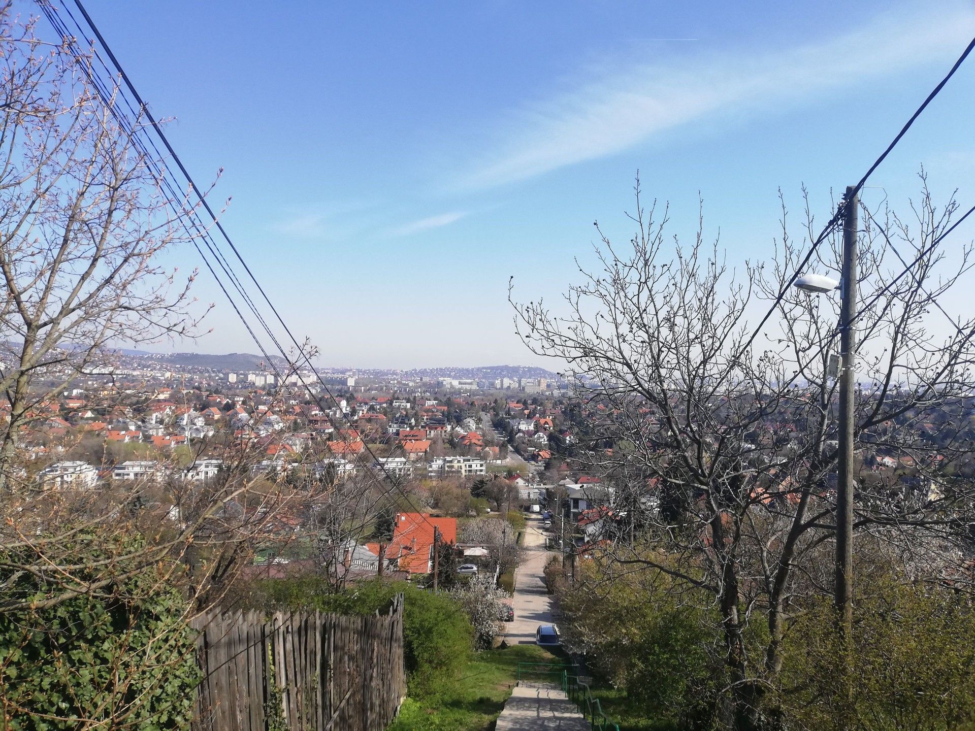
The view of Gellért Hill and its surroundings during the ascent is magnificent (Photo: Dávid Palotás/pestbuda.hu)
From Kelenvölgy, the green dash trail leads straight to the eastern end of Kamaraerdő, from where the ruins of the Benedictine monastery on the hilltop are just a 2-minute detour.
The ruins at an altitude of 202 meters, even despite the overgrown vegetation, allow visitors to imagine what the view might have been for believers stepping out of the church.
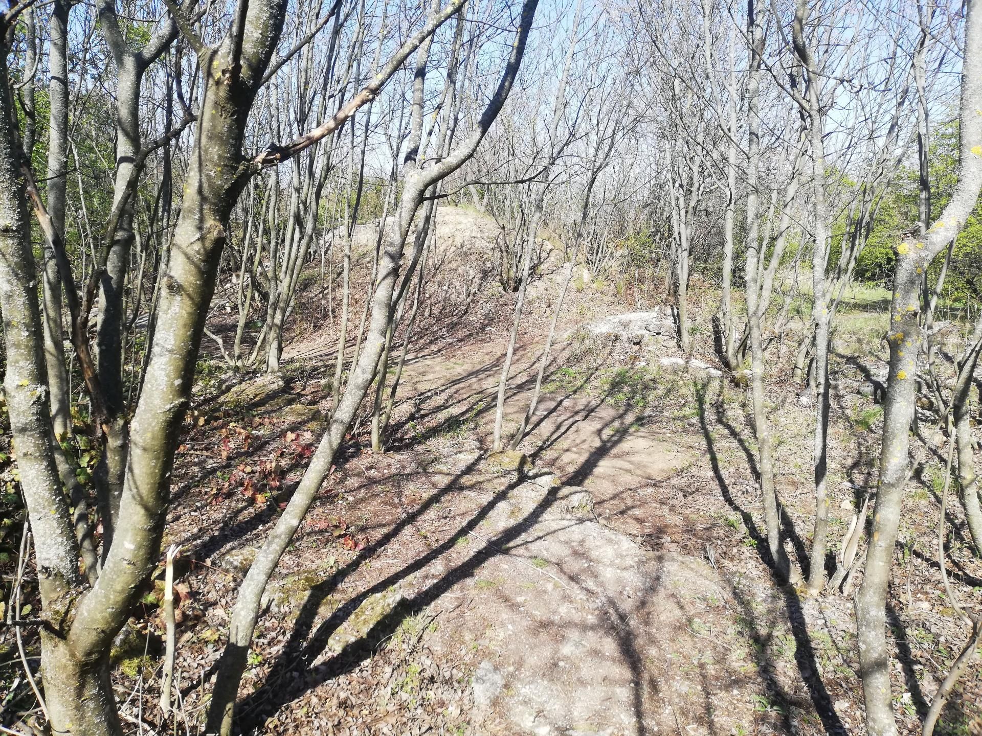
The ruins with traces of the view in the background (Photo: Dávid Palotás/pestbuda.hu)
The actual 180-hectare forest begins here, from the ruins. The constituent tree species are mainly Turkey Oaks, linden, flowering ash and field maple, towards the Tétény plateau pines, and of course, oaks. The undergrowth is therefore relatively rich; cornelian cherry, barberry and hawthorn can be seen everywhere. These plants also attract squirrels, which are common sights during quiet walks.
Continuing on the green trail, the dilapidated buildings of the former radar station are not far away. Unfortunately, this is not a very pleasant sight, but the area will hopefully be recultivated soon. From here, the highest point of Kamaraerdő, Vadász Hill (224 meters), is only a few minutes away. Several educational trails can be interesting to visit with small children because there are quite high-quality diagrams and tasks at the stations. It is no coincidence that competitions in district nurseries and primary schools are organized here.
Arriving at the heart of the Kamaraerdő, the so-called Nagyrét (Great Meadow), this becomes apparent. The area is filled with games of skill, information boards, environmental demonstrations with several fireplaces, well-designed tables and a rain cover. This is a rarity in Budapest.
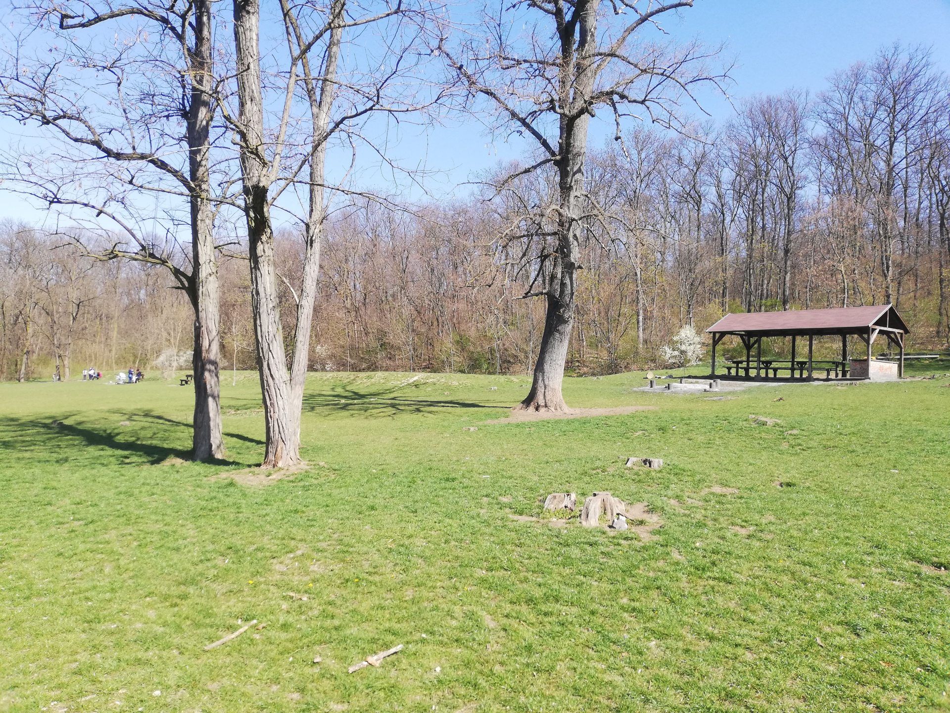
Nagyrét in Kamaraerdő (Photo: Dávid Palotás/pestbuda.hu)
From here, the blue M trail leads to the southern end of Kamaraerdő, which is at the water tower of Budafok. On open days, it’s worth visiting the modern water tower, the view from above is stunning, and the size of the water pool is also impressive. It is illuminated with blue lights and can be seen from a great distance. Unfortunately, its decorative lighting has not been turned on in recent years, despite the author's opinion that there may be demand for it.
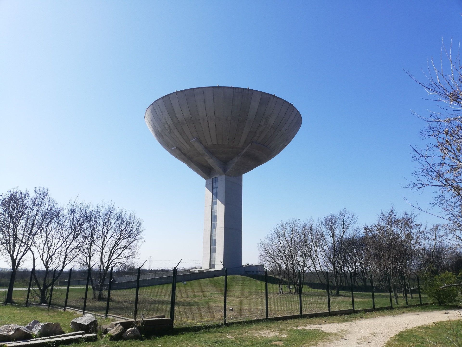
The water tower (Photo: Dávid Palotás/pestbuda.hu)
The famous Memento Park, which exhibits public works of art from before the fall of socialism, is a few minutes walk from the water tower. Some of these are the famous Osztapenko statue or a piece of the demolished Stalin statue's boots. The platform itself has been reconstructed separately, and a retro exhibition and showroom have been added to the park, making it a fairly high-quality showroom in Europe.
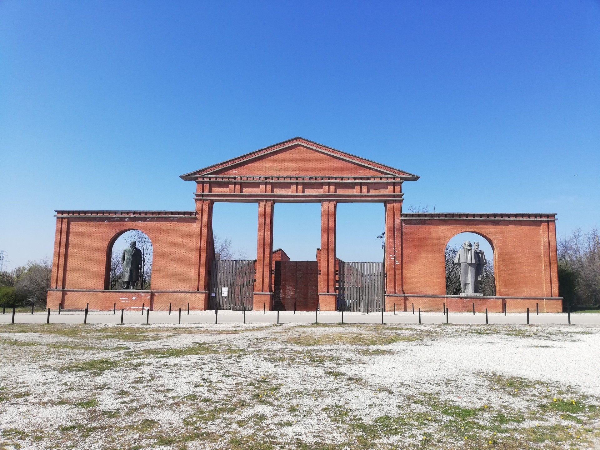
The entrance to Memento Park (Photo: Dávid Palotás/pestbuda.hu)
A column marking the old city boundary can be reached west from the water tower following the green T trail. Before Greater Budapest was created, Budafok was not part of the capital. The column now marks the district boundary.
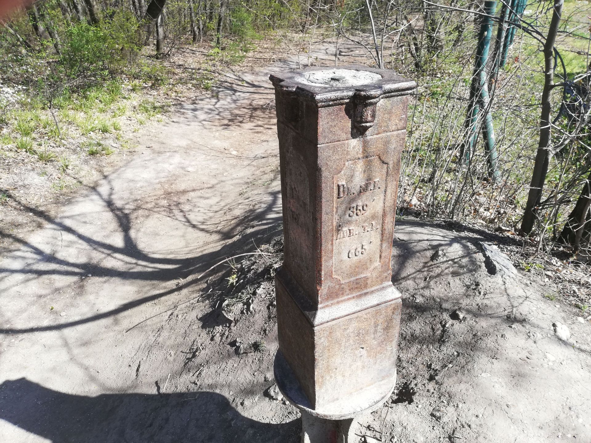
The column indicating the city boundary (Photo: Dávid Palotás/pestbuda.hu)
The path leads to the edge of Kamaraerdő and the border of the Tétényi plateau. There is so much to see on Tétényi plateau that these will be detailed in an upcoming article. The trail leads back to the Nagyrét, following the blue M trail in the other direction visitors can reach the Kamaraerdei Ifjúsági Park (Youth Park). The locale hosts many events and mini-festivals. It is worth a visit; the retro buildings in the middle of the forest have a unique atmosphere.
From here, it is a few minutes walk to the most modern curling track of Hungary and perhaps of the entire Carpathian Basin. Anyone can try the unusual but fun sport. A paintball court and a shooting range can be found not far from here towards the airport, and don't forget Budaörs Airport, which holds demonstration days and concerts several times a year, and visitors can book a pleasure flight. The best helicopter simulator in Hungary, where pilots are trained, is also located on the premises.
There is also a go-kart track at Madárhegy and a plastic ski resort at the Keserűvíz springs. The sports centre and swimming pool in Kőérberek are within walking distance too. Those interested in archaeology can visit Kána and the Roman Vicus Teuto built in the valley. The objects found are exhibited in the Archaeological Museum of Budaörs.
Excavations are also carried out periodically along the Hosszúréti stream due to the many unresearched areas. There are also plenty of outdoor, free sports courts and riding stables along the creek. This was just a taste of Kamaraerdő and its closer area, and the area holds excitement for everyone!
Cover photo: Nagyrét in Kamaraerdő (Photo: Dávid Palotás/pestbuda.hu)
A Hosszúréti-patak mentén időszakosan ásatásokat is szoktak végezni a sok fel nem tárt terület miatt. Ugyanitt a patak mentén rengeteg szabadtéri, ingyenes sportpálya és egy lovarda is fekszik. Ez a beszámoló csak egy kis ízelítő volt Kamaraerdőről és szűk környezetéről, de bátran kijelenthetjük, hogy mindenkinek tartogathat izgalmakat a környék.
Nyitókép: A kamaraerdei Nagyrét (Fotó: Palotás Dávid/pestbuda.hu)


")


